Beginning Wednesday, June 25, smoke testing of our sanitary sewer lines will begin. No action is required from residents. More information can be found by clicking the "Sewer Smoke Testing" button on the home page.
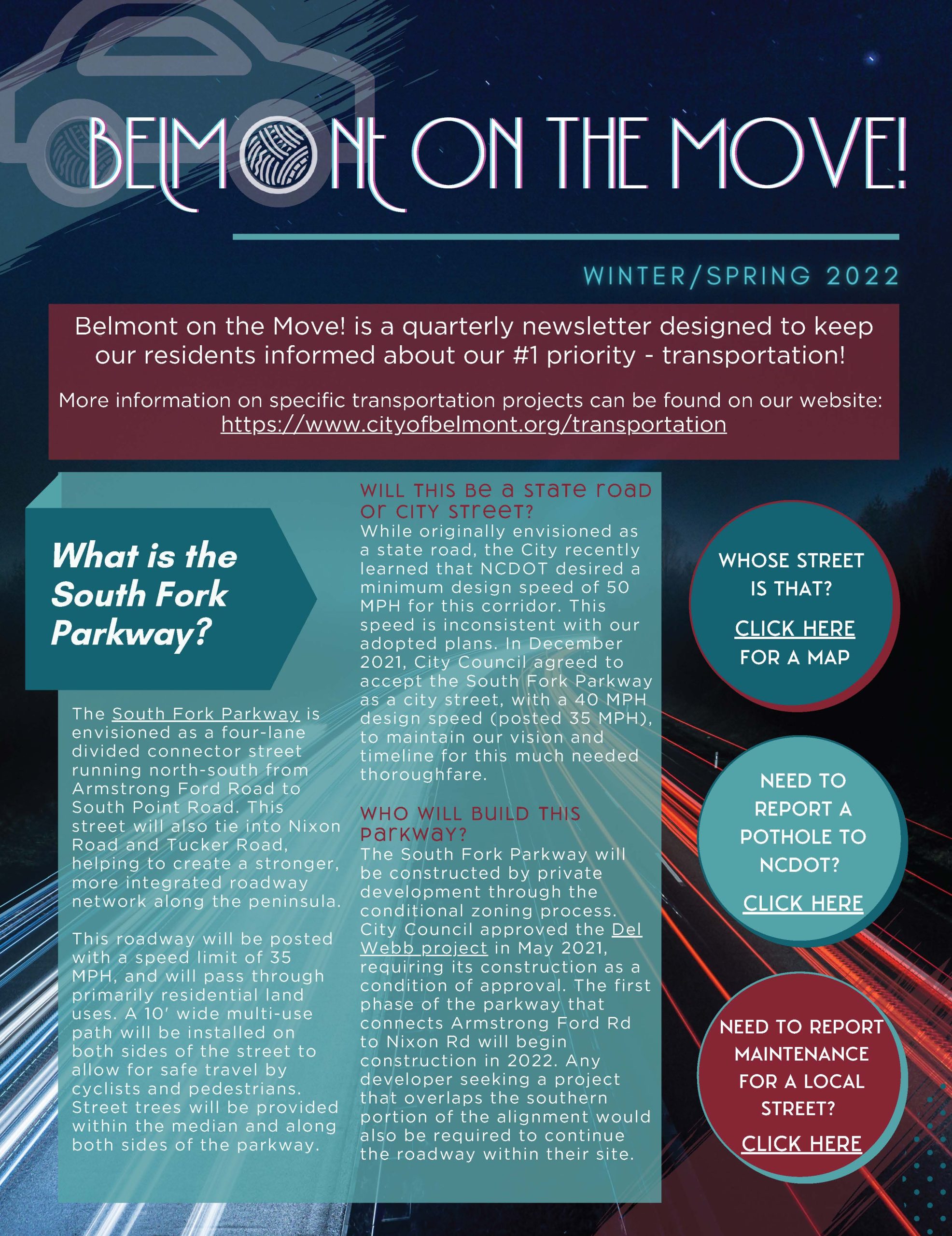
Reducing traffic and investing in transportation are consistently identified as top priorities for the City of Belmont.
The Planning and Zoning department works diligently to address these areas through the management of active transportation projects and long-range planning efforts throughout our City.
Please use the buttons below to explore projects related to each mode of transportation, or check out the News section for updates and public engagement opportunities.
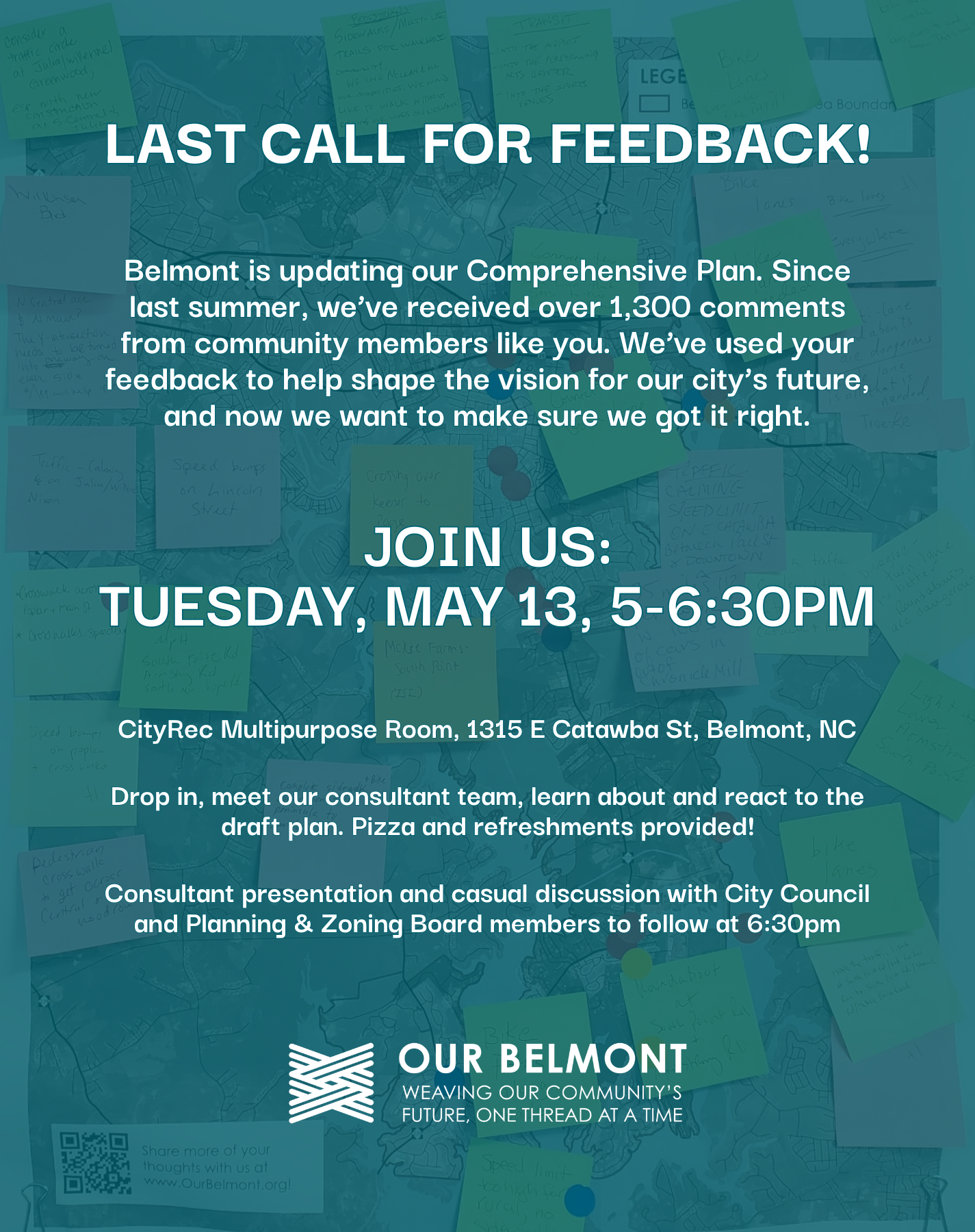
Belmont is updating our Comprehensive Plan. Since last summer, we’ve received over 1,300 comments from community members at events across the city and through digital platforms. We’ve used your feedback to help shape the vision for our city’s future, and now we want to make sure we got it right. Join us for a drop-in...
There are currently three opportunities for public engagement related to transportation initiatives in Belmont: Sloan's Ferry Bridge & Wilkinson/ Catawba Intersection (B-6051, U-6143) This project will replace the bridge on Wilkinson Boulevard (U.S. 74/ U.S. 29) over the Catawba River (Lake Wylie) on the Gaston/Mecklenburg County Line. It also includes modifications of the Catawba Street...
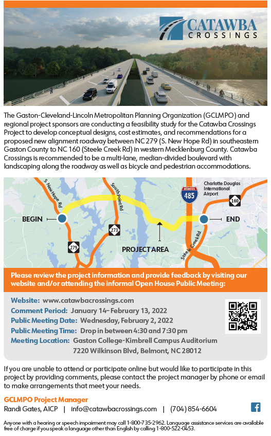
Public Comment Period: January 14 - February 13, 2022 The Gaston-Cleveland-Lincoln Metropolitan Planning Organization (GCLMPO) and regional project sponsors are conducting a feasibility study for the Catawba Crossings Project to develop conceptual designs, cost estimates, and recommendations for a proposed new alignment roadway between NC 279 (S. New Hope Rd) in southeastern Gaston County to...